I think I’ve been putting this off long enough. Time to start building the sandbox for my Seekers of Lore campaign. Normally when I plan a campaign I’ll start with the major movers and shakers, then work from there. This time I think I’ll start a little differently, with the map of the campaign region.
I broke out Hexographer from Inkwell Ideas. While I will admit that I find it a trifle frustrating at times (partly, I imagine, because I don’t use it very often and haven’t gotten used it its quirks), for building a hex-based map for roleplaying games it’s the most approachable tool I’ve found for the cost.
Start with a 36×36 map. With six-mile hexes this gives about 40,000 square miles (36*36*31.18 = 40,409.28). As a check, I live on Vancouver Island, British Columbia — which is about 12,080 square miles, a bit less than a third of this. British Columbia as a whole is 364,764 square miles, quite close to nine times this size. I really wouldn’t want to try to explore either one on foot, so while it’s small enough to be manageable on the GM side, it’s likely quite big enough for play.
Let’s see what it comes up with when I generate terrain randomly using the default configuration.
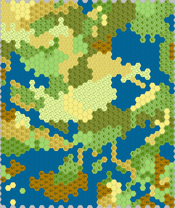
Not bad, not bad. The allocation of terrain types looks kind of off to me, but considering the origin and nature of the Seekers of Lore setting that is not inappropriate. I think I’ll take a look at a couple of other settings before I commit to anything.
The ‘Many Islands’ setting gives me something I think I rather like the look of, actually. The terrain allocations seem rather more rational, and there is a decent amount of room to explore on land (rough estimate about half the hexes, or about 20,000 square miles — still more than half again the island I live on).
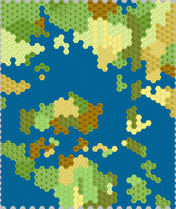
More rational, I still see some things that could use some adjustment (the parallel strips of grassland in the north stand out to me). I see four landmasses, more or less (northwest, northeast, center, south) that are separated enough for different ecology or cultures, with a few smaller ones (due east and west, and some of the middling islands). I like this one better.
The ‘Few Oceans’ setting as two major landmasses separated by a narrower strait than the ‘Many Islands’ setting. I can see several places it would be sensible to have crossings or ports, quite a bit of diversity in both landmasses, and lots of land to stomp around on.
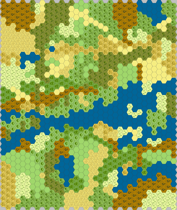
This one also has the best mountain ranges, as far as they go, and the terrain transitions look like they make more sense here. Not entirely (forested hills to dry hills?), but I don’t mind making some adjustments.
All in all I think the second map, ‘Many Islands’, is the prettiest, but this third map, ‘Few Oceans’, is likely going to be the most usable. Either one is much better for my purposes than the first, though.
In my next post I’ll start working on major landmarks and sites.
Pingback: Building a Sandbox: Major Landmarks and Sites | Keith Davies — In My Campaign - Keith's thoughts on RPG design and play.