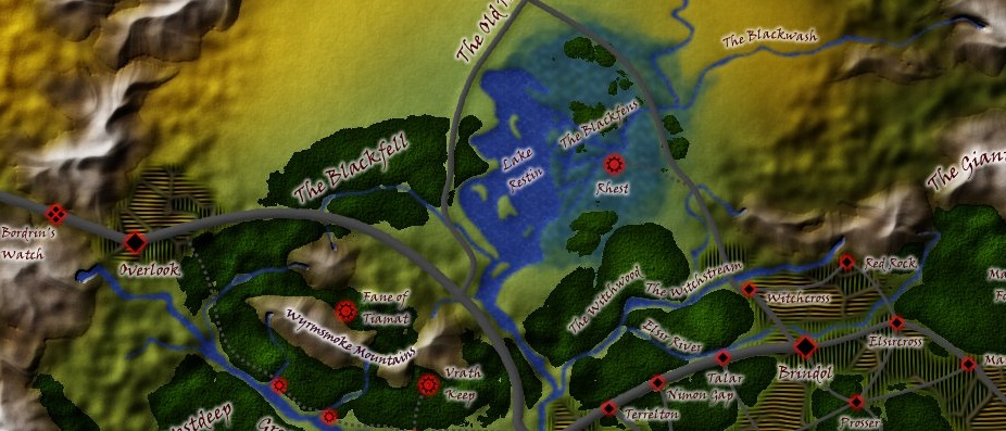
A friend of mind is running a D&D 4e campaign and was unhappy with one of the maps he was using. In order to get a complete view of the Vale he was using several maps butted together. They had differences in color and style (which never looks good) and some weird geography that got on his nerves. Mine too, when I saw it.
I’d been looking for a challenge, and this looked like an interesting one. He sent me a copy of the original, marked up where he wanted changes. Extend a mountain range here, chop this river in half so it doesn’t go over the mountain range as in the original, and so on.
I’ve spent perhaps 15 hours on this in the last few days, usually a couple of hours at a time in the evening while we hashed out what was being done with the map. It’s fairly close to what I’d originally scribbled as a starting point, but some things got moved or changed as we came up with better ideas.
Of course, I see some room for improvement yet, some specific things to work on next time. However, this was my first time compositing something this complex, and overall I’m quite satisfied.

